= = = W N 1 Z = = =

Nemo me impune lacessit!


hamster status: ACTIVE
wn1z.orrin@gmail.com


NASA Fans !


Satellite Passes Over WN1Z QTH (drop-down box)


My Bubble Center (Allstar) !


(below): Click on image to get your location based on your IP address.
Like you really don't know where you are LOL.


Allstar System of Linked Nodes and Repeaters

Click on the map to get the interactive Google map


Allstar Info Page


Current airline traffic in my area KSVE Susanville Municipal Airport vicinity


I am a feeder station for Flightaware.com


HF Radio Conditions and "Short Skip" Prospects -- Awesomely Current!

If you click on this image (not current), it will take you to a current
ionosonde for Boulder, Colorado, which likely covers much of western
North America at that latitude. You don't have to understand the graph itself.
At the bottom left is a row of data indicating what the MUF is for various
distances away from you. So for example, if the MUF for 100 miles is 6.5 MHz,
you will probably not be able to do short-skip (NVIS etc.) for 7.2 MHz. Also
look (upper left) for the foF2 frequency in MHz, that is truly the
NVIS cutoff freq. AGAIN: click on the image to get the current info.


HAMCLOCK -- Amazing Tool for HF Propagation Conditions (VOACAP etc) and Satellite Tracking


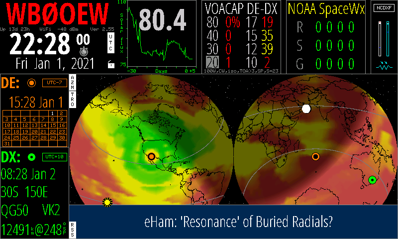
WB0OEY Hamclock website here


This app is better than all the other HF-related tools on my page here. The app runs on a Raspberry
Pi 3B or Pi4 (that I've tested) and from what the author says, it may run on a PC under Ubuntu 18.04
and even a Mac. The map can be toggled between 'globe' (like here) or a Mercator map.


Some HF indices (current)


Gridsquares Worked on FT8, August 1 2017 to March 20, 2021. Actual log appears below that.

The list of contacts is "under construction."
http://wg7j.reinalda.net/gridmapper/gridmapper.php


VOACAP Custom Predictions
This is not a real-time image. Click on the image below to go to voacap.com:

For many tools related to the map shown above, go here


foF2: F2-Layer Critical Frequency Map
The map below is a real-time image.
It shows the maximum radio frequency that can be reflected by the
F2-region of the ionosphere at vertical incidence (that is, when
the signal is transmitted straight up into the ionosphere). This
definitely shows why, many days, short-skip on e.g. 40 meters is
just not possible. (See the ionosonde diagram at the top of this
website for more F2 info.)
From www.sws.bom.gov.au


WSPR Mode


Worldwide WSPR Activity, can filter by callsign and band
WSPR Basics
WSPR Frequencies
Author K1JT WSPR page


Solar info courtesy N0NBH (not including the NOAA bar chart, and the foF2 maps)


Magnetic Loop and Small Loop Antennas

...


List of all U.S. AM BCB stations!

Can be sorted by frequency, callsign, location, etc.


Clear Channel AM Broadcast Band Stations (BCB DXing at night)


Radio locator


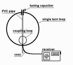
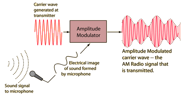
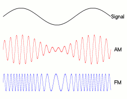
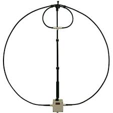
Images in this AM BCB sub-section are from google image searches and also a site by K0UK


NAVTEX Stations at 518 kHz (517 USB dial, 1000Hz offset)

Station Identifier WX Broadcast Schedule (UTC)
Effective August 14, 2012 at 0000 UTC
Adak X (Broadcast terminated Dec ‘96)
Kodiak1 J
X
0130, 0530, 09302, 1330, 1730, 21302
0350, 0750, 11502, 1550, 1950, 23502
Astoria W 03402, 0740, 1140, 15402, 1940, 2340
San Francisco C 0020, 04202, 0820, 1220, 16202, 2020
Cambria Q 02402, 0640, 1040, 14402, 1840, 2240
Marianas V 0330, 0730, 1130, 1530, 1930, 2330
Honolulu O 0220, 0620, 10202, 1420, 1820, 22202
Boston F 0050, 0450, 08502, 1250, 1650, 20502
Portsmouth N 02102, 0610, 1010, 14102, 1810, 2210
CharlestonE0040, 0440, 08402, 1240, 1640, 20402
Miami A 0000, 0400, 08002, 1200, 1600, 20002
San Juan R 02502, 0650, 1050, 14502, 1850, 2250
New Orleans G 0100, 0500, 09002, 1300, 1700, 21002
1. Kodiak also broadcasts weather forecasts during time slots initially allocated to Adak.

2. Routine weather forecasts are broadcast four times per day with these being the normal times when repeats of Notices to Mariners are broadcast in lieu of weather. Weather warnings may be broadcast at any time.

The U.S. Coast Guard may on occasion have to defer or shorten the broadcast of a scheduled weather forecast via NAVTEX to ensure delivery of more urgent navigational and safety warnings.

NAVTEX receivers must be programmed with proper NAVTEX station and subject identifiers in order to receive weather broadcasts.

It is intended that all NAVTEX weather be broadcast with subject indicator "B", for Meteorological Warnings, which cannot be rejected by the NAVTEX receiver, or "E" for routine forecasts. However, this cannot be fully implemented at the present time within the U.S. Therefore, all mariners in U.S. waters should program their NAVTEX receivers to include subject indicator "E" in order to receive both warnings and routine weather forecasts via NAVTEX.

Effective April 22, 2008 U.S. NAVTEX broadcasts of weather forecasts containing a warning or a Dense Fog Advisory will be broadcast with a Subject Indicator of "B" vs. "E", such that receipt cannot be suppressed on the user's equipment. Mariners are encouraged to include subject indicator "E" in programming their NAVTEX in order to receive routine weather forecasts as well as weather warnings via NAVTEX.

Above table is from: NOAA. And then click on the selection for NAVTEX.


More Navtex links:


  • LF/MF G4UCJ Hula-Loop Antenna for receiving 300 to 1700 kHz. I built one of these, without the pre-amp, and it's great.


    The PDF is available here.


  • Yagi Antenna Calculator! Which i wrote in Javascript in 1997-2012.
  • MMANA-GAL Antenna Analyzer ... for many antennas and can use the Yagi calculator results
  •  


    They're waiting for us!


  • OTA (over-the-air) TV Stations: Susanville, California (not up-to-date)


    Page last revised 23 May 2021 at 0500Z

    The graphic of the spark-gap radio station was taken from http://home.windstream.net/adye/webpages/Spark%20Gap.htm, which page no longer exists apparently.
    Royal emblem is from https://commons.wikimedia.org
    "Nemo me impune lacessit" = "No one assails me with impunity!"